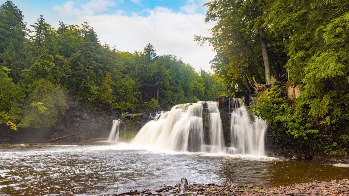
Michigan’s Upper Peninsula holds a secret that surprises many first-time visitors: more than 300 waterfalls tucked into its forests, gorges, and river valleys. From thundering cascades that rank among the largest east of the Mississippi to hidden gems requiring a short hike through old-growth hemlock, the UP delivers waterfall experiences unlike anywhere else in the Midwest.
For campers, the UP presents an ideal setup: campgrounds positioned within minutes of major waterfall clusters, allowing you to explore multiple falls from a single base camp. Whether you’re planning a weekend trip along the Black River Scenic Byway or a week-long circuit hitting the peninsula’s greatest hits, this guide covers everything you need to know.
Quick Facts Before You Go
Before diving into the details, here’s what you need to know at a glance:
- Total waterfalls: 300+ documented (some researchers have found 600-800+)
- Best season for water flow: Late April through June (snowmelt)
- Best season for camping: June through September
- Must-see falls: Tahquamenon, Bond Falls, Laughing Whitefish Falls
- Trail difficulty: Most trails are easy to moderate
- Dog policy: Most trails allow leashed dogs
| Trip Length | Recommended Region | Must-See Falls | Campground Base |
|---|---|---|---|
| Day trip | Munising area | Miners Falls, Wagner Falls | N/A |
| Weekend | Black River Byway | Rainbow, Gorge, Potawatomi | Black River Harbor |
| Week+ | Full UP circuit | Tahquamenon, Bond, Laughing Whitefish | Multiple stops |
Why the Upper Peninsula Has So Many Waterfalls
Ever wonder why Michigan’s waterfalls are almost exclusively found in the Upper Peninsula? The answer lies beneath your feet—in rock formations that began taking shape over a billion years ago.
The Midcontinent Rift: A Billion-Year Story
About 1.1 billion years ago, the Earth’s crust began pulling apart across what’s now the Great Lakes region. This geological event, called the Midcontinent Rift, stretched for over 2,000 kilometers and triggered volcanic eruptions that lasted roughly 24 million years.
The lava that erupted eventually cooled into basalt—the same dark volcanic rock that forms Hawaii and Iceland. This hardened lava created the Portage Lake Volcanics layer, a belt of tough rock that runs through the western UP. When softer rock eroded away over millennia, the resistant volcanic rock remained, creating the cliffs and ledges where water now tumbles.
Rock Layers and Waterfall Formation
Most UP waterfalls exist where hard volcanic rock sits above softer sedimentary rock. Rivers and streams gradually wore away the softer material, leaving behind cliffs of ancient basalt. The Keweenaw Fault—a major crack in the Earth’s crust running through the Keweenaw Peninsula—also created dramatic elevation changes that produce waterfalls.
Understanding this geology adds depth to your waterfall visits. Those dark cliff faces you see behind the falls? That’s billion-year-old volcanic rock. The tannin-brown water at Tahquamenon Falls? That’s from cedar swamps the river drains, not pollution.
Best Season to Visit UP Waterfalls
Your timing shapes the entire waterfall experience. Here’s what each season offers for campers and waterfall chasers.
Spring (April-June): Peak Water Flow
Spring snowmelt transforms UP waterfalls into their most powerful state. Rivers swell with runoff, and even modest cascades become impressive. Tahquamenon Falls can drain up to 50,000 gallons per second during peak spring flow.
Pros: Most dramatic water volume, fewer crowds early season
Cons: Muddy trails, some campgrounds don’t open until mid-May, black flies emerge in late May
Camping note: Most state park campgrounds open mid-May. National forest campgrounds vary—Black River Harbor typically opens in May but check current conditions.
Summer (July-August): Best for Camping
Summer brings warmer weather, drier trails, and prime family camping conditions. Water flow drops compared to spring, but falls remain photogenic and swimming holes downstream become inviting on hot days.
Pros: Best camping weather, all facilities open, longer daylight for exploring
Cons: Peak crowds at popular falls, lower water flow, mosquitoes active
Camping note: Reserve campgrounds early, especially for July and August weekends. Popular sites book months ahead.
Fall (September-October): Foliage and Falls
Fall colors frame waterfalls with reds, oranges, and yellows. Crowds thin after Labor Day, and cooler temperatures make hiking more comfortable. Water flow varies—recent rainfall can boost volume.
Pros: Spectacular foliage backdrop, fewer visitors, comfortable hiking weather
Cons: Campgrounds close mid-October, weather becomes unpredictable, shorter days
Camping note: Most campgrounds close October 15. Bring extra layers—nights get cold.
Winter (November-March): Frozen Falls
Frozen waterfalls draw ice climbers to Munising and offer photographers unique scenes. Access becomes challenging, but dedicated visitors find the UP transformed into a winter wonderland.
Pros: Unique ice formations, solitude, ice climbing opportunities
Cons: Limited campground availability, roads may be impassable, requires winter gear expertise
Camping note: Only a few campgrounds offer winter camping. Come prepared for extreme cold.
Must-See Waterfalls in the Upper Peninsula
With 300+ options, prioritizing can be overwhelming. These falls represent the essential UP waterfall experience—each offering something distinct.
Tahquamenon Falls: The Crown Jewel
Tahquamenon Falls State Park covers nearly 50,000 acres and contains Michigan’s most famous waterfall. The Upper Falls drops approximately 48 feet over a ledge nearly 200 feet wide, making it the third most voluminous waterfall east of the Mississippi River.
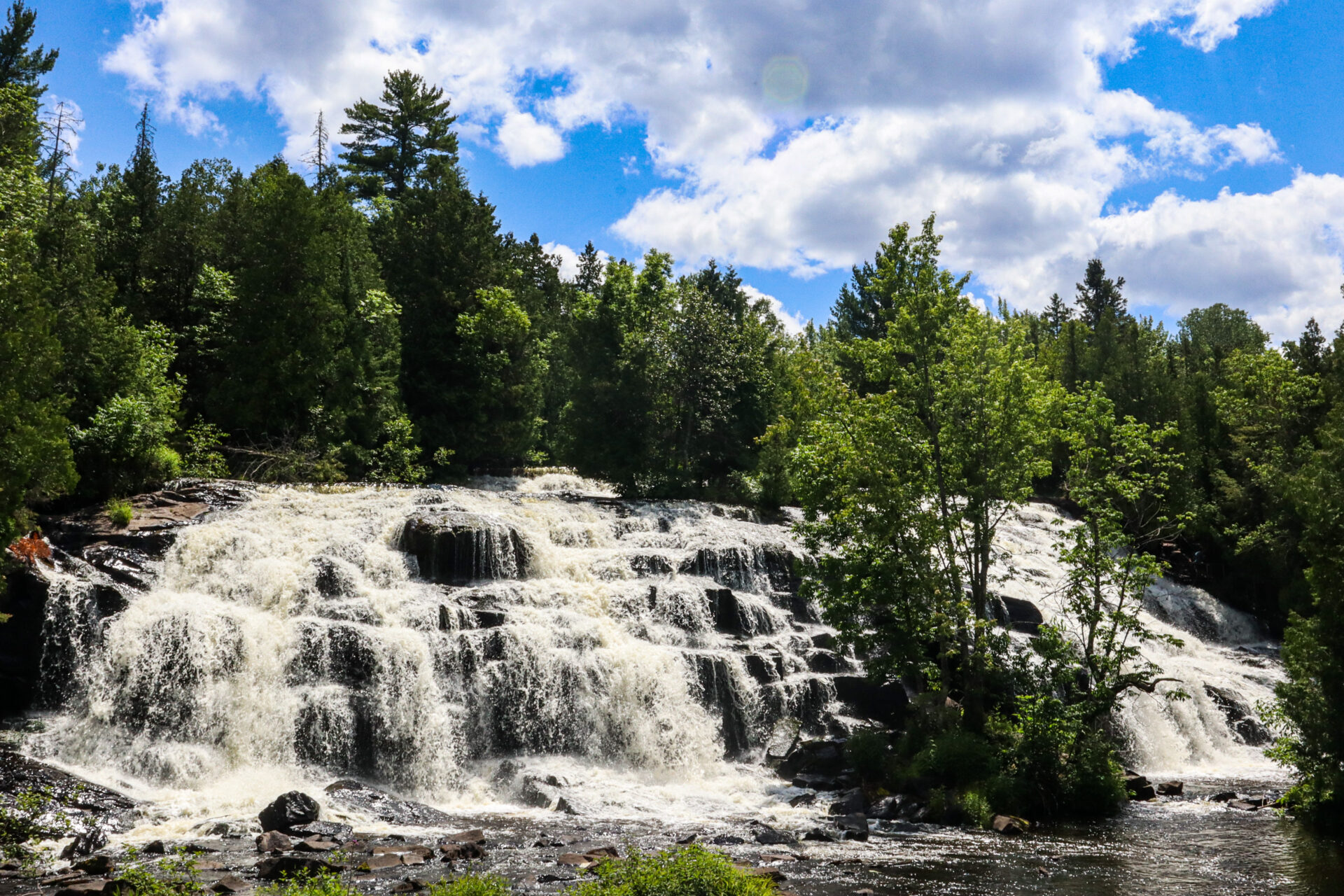
Trail details: The Upper Falls viewpoint sits about 0.5 miles from parking via a paved, accessible path. The Lower Falls, four miles downstream, features a 4-mile loop trail around an island with five smaller cascades.
Camping option: Tahquamenon Falls State Park offers modern campgrounds at Lower Falls and Rivermouth, plus rustic sites and backcountry camping along the North Country Trail.
Bond Falls: The Most Photogenic
Bond Falls ranks among the most photographed waterfalls in Michigan for good reason. Water tumbles 50 feet over fractured rock, spreading 100 feet wide across multiple cascading channels. A 600-foot accessible boardwalk provides six viewing platforms at different angles.
Trail details: The 1-mile loop trail is easy and suitable for all skill levels. The main viewing deck is wheelchair accessible. A staircase leads to Upper Bond Falls and additional cascades upstream.
Camping option: Bond Falls Flowage and nearby Ottawa National Forest campgrounds provide options within a short drive.
Access note: Bond Falls Scenic Site requires a Michigan Recreation Passport ($14/year for residents, $42/year for non-residents as of 2026). Vehicle access runs mid-May through mid-October; hiking access is year-round.
Laughing Whitefish Falls: The Hidden Giant
Laughing Whitefish Falls might be the UP’s most underrated major waterfall. This 100-foot slide cascade fans out dramatically over an escarpment, creating a wall of white water that’s unlike any other fall in the region.
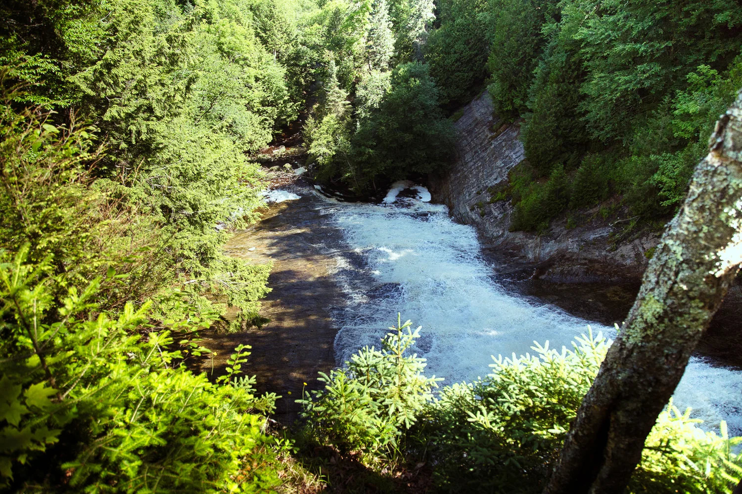
Trail details: A half-mile natural surface trail leads to three observation platforms at different levels. The upper platform requires no stairs; reaching the middle platform takes 20 stairs, and the bottom platform requires 137 stairs from the top. Budget 1-2 hours for a complete visit.
Camping option: No camping at the falls, but nearby state forest and national forest campgrounds offer options. The falls sit about 30 minutes from both Marquette and Munising.
Miners Falls: Pictured Rocks Gateway
Located within Pictured Rocks National Lakeshore, Miners Falls offers a 40-60 foot plunge into a rocky gorge. The well-maintained trail makes this an ideal introduction to UP waterfalls, especially if you’re already visiting the famous Pictured Rocks cliffs.
Trail details: The Miners Falls Trail covers 1.2 miles round trip with 154 feet of elevation gain. Rated easy, the gravel path ends at a viewing platform accessed by 64 stairs.
Camping option: Pictured Rocks offers three drive-in campgrounds—Twelvemile Beach (36 sites), Little Beaver Lake (8 sites), and Hurricane River—plus 14 backcountry campgrounds along the Lakeshore Trail. Reservations required through Recreation.gov.
Regional Waterfall Itineraries
The UP’s waterfalls cluster in distinct regions. Planning by region helps maximize your time and minimize driving.
Western UP: Black River Scenic Byway
Campground base: Black River Harbor Campground (38 sites, $22/night, Ottawa National Forest)
The Black River Scenic Byway packs five waterfalls along one river corridor, all accessible from short trails. You can see all five in a single day with energy to spare.
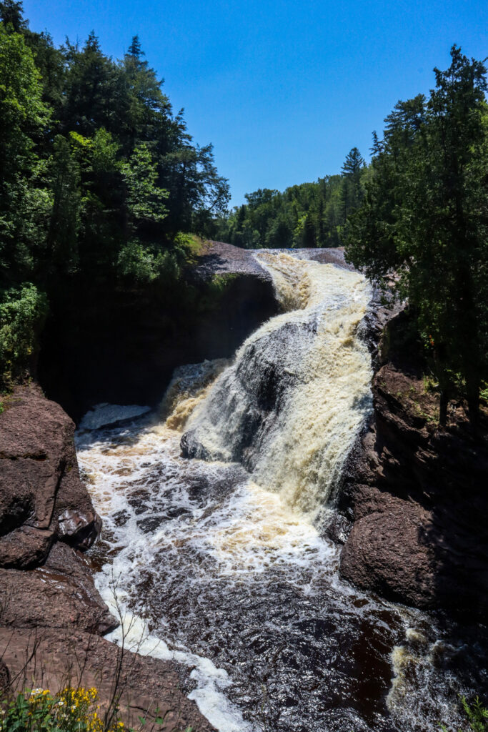
- Rainbow Falls: 30-foot drop, 1.5 miles round trip, two different viewing options
- Sandstone Falls: 15-foot drop, 0.3 miles round trip, rocky shoreline access
- Gorge Falls: 20-foot drop through a narrow gorge, 0.5-mile loop with Potawatomi Falls
- Potawatomi Falls: 30-foot cascade across rock face, shared trail with Gorge Falls
- Great Conglomerate Falls: 20-foot drop split around conglomerate rock, 0.75 miles
2026 note: Black River Harbor Campground has no water available for the entire 2026 season. Plan to bring your own water supply.
Central UP: Marquette and Munising Area
Campground base: Pictured Rocks campgrounds or Marquette area options
This region combines accessible roadside waterfalls with backcountry options within Pictured Rocks National Lakeshore.
- Laughing Whitefish Falls: 100-foot slide, 1 mile round trip
- Miners Falls: 40-60 feet, 1.2 miles round trip (Pictured Rocks)
- Munising Falls: 50 feet, 0.8 miles round trip, accessible boardwalk
- Wagner Falls: 20 feet, accessible boardwalk—excellent for families
Eastern UP: Tahquamenon Region
Campground base: Tahquamenon Falls State Park campgrounds
The eastern UP centers on Tahquamenon Falls State Park, which alone justifies a multi-day camping trip.
- Upper Tahquamenon Falls: 48 feet tall, 200 feet wide, easy paved access
- Lower Tahquamenon Falls: Series of five cascades, 4-mile loop trail
Border Region: Michigan/Wisconsin
Campground base: Ottawa National Forest campgrounds
Several impressive waterfalls sit right on the Michigan-Wisconsin border along the Montreal River.
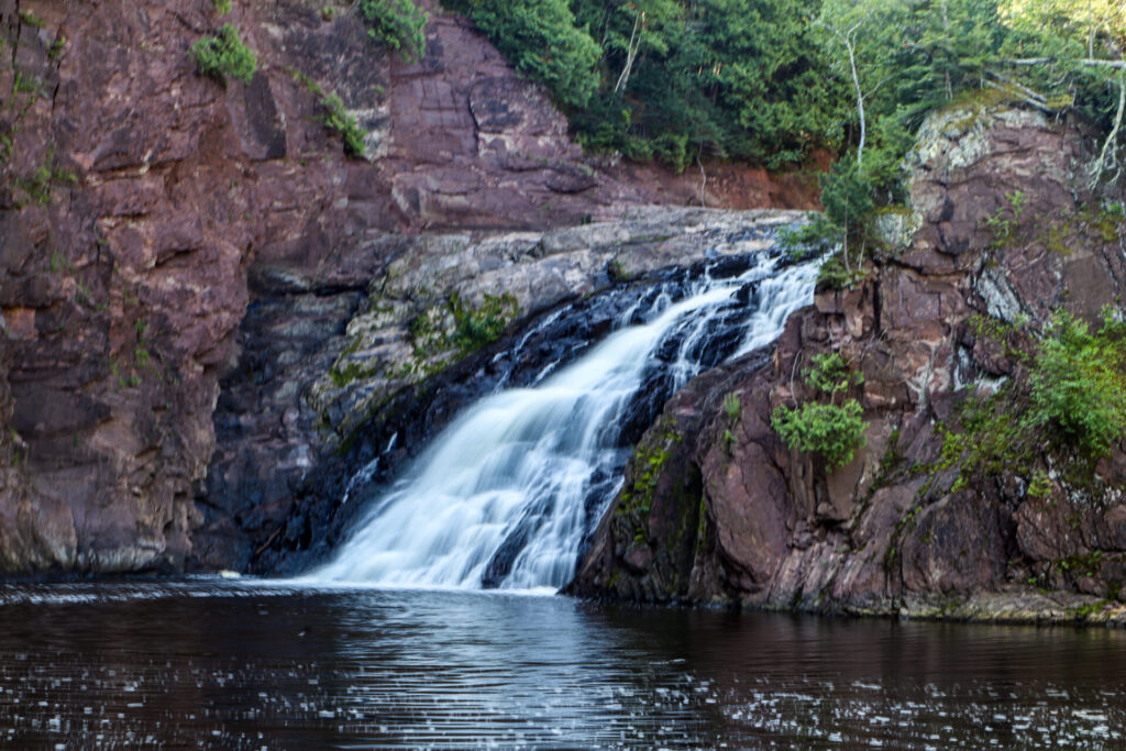
- Superior Falls: 90-foot drop into Lake Superior, 0.7 miles, moderate trail with chain railing
- Saxon Falls: 90-foot total drop, short walk, overlook from above
- Interstate Falls: 18-foot drop, 0.7 miles, accessed from Wisconsin side
Camping Near Waterfalls: Where to Stay
One of the best things about exploring UP waterfalls is the abundance of nearby camping options. Here’s how to match your camping style with the right spot.
State Park Campgrounds
Tahquamenon Falls State Park offers the most waterfall-adjacent camping, with sites just minutes from both the Upper and Lower Falls. The Lower Falls Modern Campground includes showers and electricity; Rivermouth Rustic Campground provides a more primitive experience along the river.
Porcupine Mountains Wilderness State Park in the western UP combines campgrounds with access to the Presque Isle River waterfalls—multiple cascades along a scenic stretch of river.
Reservation tip: Book through Michigan DNR Reservations or call 1-800-447-2757. Popular dates book quickly—plan months ahead for peak summer weekends.
National Forest Campgrounds
The Ottawa and Hiawatha National Forests offer numerous campgrounds near waterfall routes.
Black River Harbor Campground (Ottawa NF) puts you at the doorstep of five waterfalls along the Black River Scenic Byway. The 38 wooded sites sit on a bluff overlooking Lake Superior. No electricity, vault toilets. $22/night, reservable through Recreation.gov.
National Lakeshore Camping
Pictured Rocks National Lakeshore offers both drive-in campgrounds and backcountry sites:
- Drive-in options: Twelvemile Beach (36 sites), Little Beaver Lake (8 sites), Hurricane River
- Backcountry: 14 campgrounds spaced 2-5 miles apart along the Lakeshore Trail
- Season: May 15 – October 15 for drive-in sites; backcountry permits required year-round
Dispersed Camping
National forest lands allow dispersed camping (free primitive camping) outside of developed areas. This option works well for experienced campers who don’t need facilities. Check specific regulations for the Ottawa and Hiawatha National Forests before setting up camp.
Waterfall Comparison Table
Use this table to compare major UP waterfalls and plan which ones fit your trip.
| Waterfall | Height | Trail Distance | Difficulty | Dog-Friendly | Camping Nearby |
|---|---|---|---|---|---|
| Tahquamenon Upper | 48 ft | 0.5 mi | Easy | Yes (leashed) | State Park |
| Tahquamenon Lower | Series | 4 mi loop | Moderate | Yes (leashed) | State Park |
| Bond Falls | 50 ft | 1 mi loop | Easy | Yes | USFS nearby |
| Laughing Whitefish | 100 ft | 1 mi RT | Easy-Mod | Yes (leashed) | Nearby options |
| Miners Falls | 40-60 ft | 1.2 mi RT | Easy | No (NPS) | Pictured Rocks |
| Rainbow Falls | 30 ft | 1.5 mi RT | Easy | Yes | Black River Harbor |
| Superior Falls | 90 ft | 0.7 mi RT | Moderate | Yes | USFS nearby |
| Gorge Falls | 20 ft | 0.5 mi loop | Easy | Yes | Black River Harbor |
Who Should Visit Which Waterfalls
Not every waterfall suits every visitor. Here’s how to match falls to your situation.
Best for Families with Young Kids
- Tahquamenon Falls (Upper): Paved paths to viewing area, no difficult terrain
- Wagner Falls: Wheelchair accessible boardwalk, short walk
- Bond Falls: Accessible boardwalk, multiple platforms, gift shop with snacks
Best for Photographers
- Bond Falls: Multiple angles from six viewing platforms, wide cascade creates layered compositions
- Rainbow Falls: Dramatic gorge setting, best shot from the suspension bridge trail
- Laughing Whitefish Falls: Unique fan shape, three viewing levels for different perspectives
Best for Hikers Seeking a Challenge
- Presque Isle River Falls: Multiple cascades along a scenic trail system
- North Country Trail sections: Connect waterfall visits with longer backpacking routes
- Pictured Rocks backcountry: Combine coastal scenery with waterfall side trips
Best for Dogs
- All Black River Scenic Byway falls: Dog-friendly trails throughout
- Fumee Falls: Easy access, leashed dogs welcome
- Superior Falls: Dogs allowed on leash
Note: Pictured Rocks National Lakeshore does not allow dogs on most trails, including Miners Falls.
Essential Gear for Waterfall Camping Trips
Exploring waterfalls while camping requires thoughtful packing. Here’s what to bring beyond your standard camping gear.
Hiking Gear
- Sturdy footwear: Rocks near falls get slippery. Hiking boots or shoes with good grip are essential.
- Trekking poles: Helpful for steep descents to viewing platforms
- Waterproof day pack: Mist near falls can soak gear
- Extra dry clothes: Keep a change in the car for after waterfall visits
Photography Gear
- Tripod: Essential for long exposure shots that create silky water effects
- Waterproof bag or case: Protects camera gear from spray
- Polarizing filter: Reduces glare and enhances colors
- Microfiber cloth: For wiping mist off your lens
Camping Considerations
- Rain gear: UP weather changes quickly; be prepared for afternoon showers
- Layers: Mornings run cool even in summer, especially near water
- Bug protection: Black flies peak in late May/early June; mosquitoes persist all summer
- Water containers: Some campgrounds (like Black River Harbor in 2026) lack potable water
Tips for Visiting UP Waterfalls
Trail Conditions and Safety
Rocks near waterfalls stay wet and slippery year-round. Stay on designated trails and behind railings—several people have been injured or killed after leaving marked paths at UP waterfalls. Check current trail conditions before heading out, especially in spring when winter damage may close sections.
Leave No Trace
The UP’s natural beauty depends on visitors treating it well. Pack out all trash (some parks have no garbage cans), stay on established trails, and avoid climbing on rock formations. Use the boot brushes at trailheads to prevent spreading invasive species between sites.
Photography Tips
- Best light: Early morning or late afternoon avoids harsh midday shadows
- Long exposures: Use shutter speeds of 1/4 second or longer for silky water effects
- Smartphone tip: On iPhone, take a Live Photo and convert to Long Exposure in your photo library
- Composition: Include foreground rocks or foliage to add depth
Frequently Asked Questions
How many waterfalls are in Michigan’s Upper Peninsula?
The UP has over 300 documented waterfalls, with some researchers claiming to have found 600-800+. Conservative estimates put the number at “nearly 200 named waterfalls,” but many smaller cascades go unnamed. The UP contains all but one of Michigan’s waterfalls—the lone exception is in the Lower Peninsula.
What is the best time of year to see UP waterfalls?
Late spring (May-June) offers the most dramatic water flow from snowmelt. Summer provides the best camping weather but lower water levels. Fall brings stunning foliage but cooling temperatures. Winter transforms many falls into ice sculptures, though access becomes challenging.
Are UP waterfall trails dog-friendly?
Most trails allow leashed dogs—state parks require a 6-foot leash. The major exception is Pictured Rocks National Lakeshore, which prohibits dogs on most trails including Miners Falls. Always check specific regulations before bringing your pet.
Can I swim at UP waterfalls?
Swimming is generally not recommended or prohibited at most waterfalls due to strong currents, cold water, and slippery rocks. Some areas have designated swimming spots downstream from falls, but use caution. The water temperature remains cold even in summer.
Do I need a pass to visit waterfalls?
It depends on the location. Michigan state parks require a Recreation Passport ($14/year for residents, $42/year for non-residents as of 2026). Pictured Rocks National Lakeshore charges an entrance fee. Many waterfalls on national forest land are free to visit. The America the Beautiful pass covers federal lands.
Which waterfall is the biggest in the UP?
Tahquamenon Falls’ Upper Falls is the largest, measuring approximately 48 feet tall and nearly 200 feet wide. It ranks as the third most voluminous waterfall east of the Mississippi River, with peak spring flows reaching 50,000 gallons per second.
Can I camp near waterfalls in the UP?
Yes—numerous campgrounds sit within easy driving distance of major waterfalls. Tahquamenon Falls State Park offers the most direct waterfall-adjacent camping. Black River Harbor Campground in Ottawa National Forest provides access to five waterfalls. Pictured Rocks has both drive-in and backcountry camping options.
Are UP waterfalls accessible year-round?
Most are accessible spring through fall, with peak visitor season running May through October. Winter access varies significantly—some trails close or become impassable, while others draw ice climbers and snowshoers. Roads to remote falls may not be plowed.
Planning Your UP Waterfall Adventure
Michigan’s Upper Peninsula offers something rare: a concentrated collection of waterfalls that rivals anywhere in the eastern United States, combined with abundant camping options that let you explore at your own pace. Whether you’re chasing the thundering power of spring snowmelt at Tahquamenon or enjoying a quiet summer evening at a Black River Scenic Byway campsite, the UP delivers.
The key to a successful trip lies in matching your timing and destination to your goals. Visit in late spring for dramatic water flow, summer for ideal camping conditions, or fall for the bonus of brilliant foliage. Base yourself at a campground near your target waterfalls, and you’ll maximize time exploring rather than driving.
With 300+ waterfalls scattered across the peninsula, you could spend years exploring and still find new cascades tucked into the forest. That’s part of what makes the UP special—there’s always another waterfall waiting around the bend, another trail leading to a viewpoint you haven’t seen, another campsite with the sound of rushing water just out of sight.